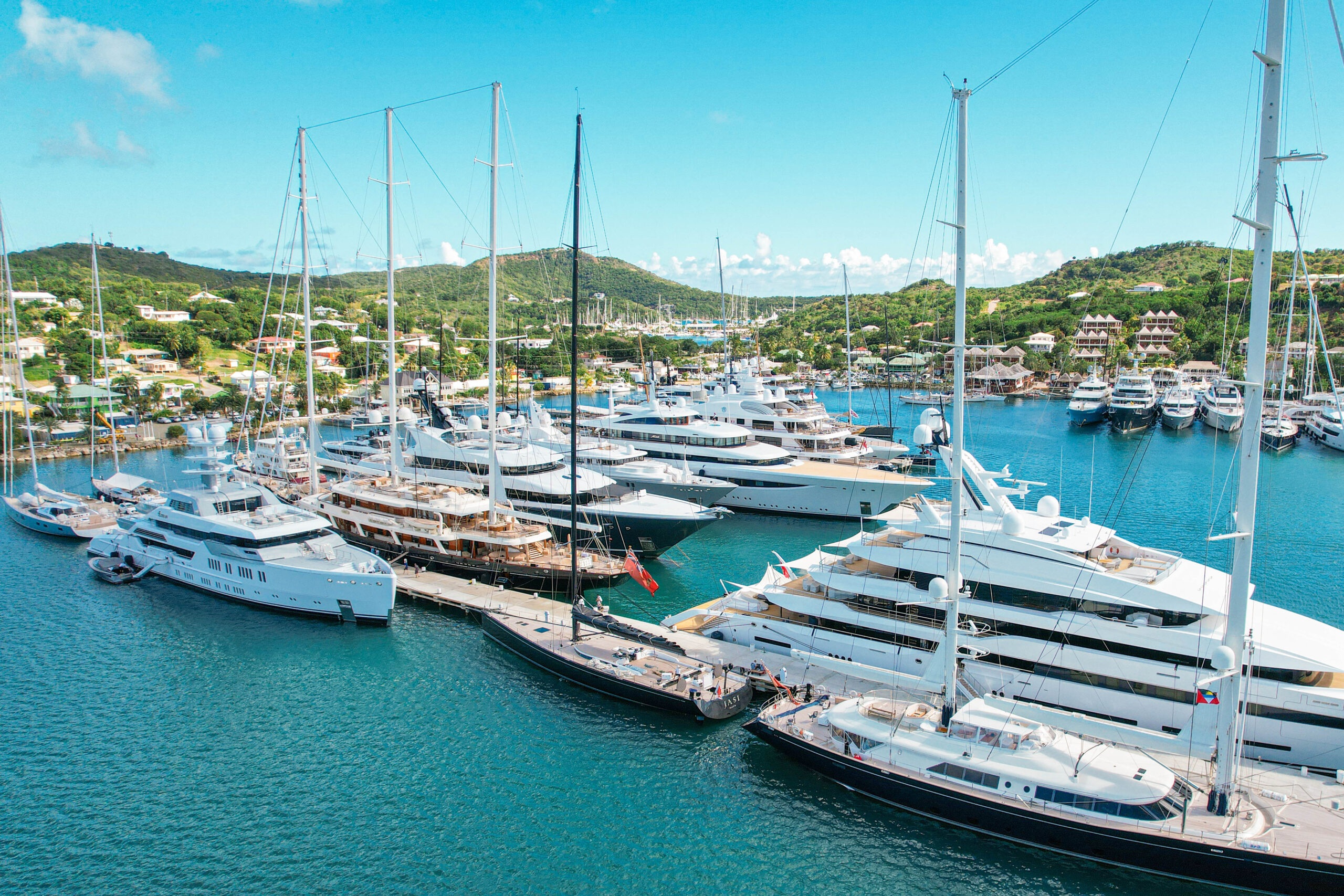
From the heights above English Harbour, Antigua’s southern coast becomes a composition of enclosed water, green ridges and masts. Down at the quays, the scale changes to stone buildings, working pontoons and the passage between land and yacht. English Harbour and neighbouring Falmouth Harbour offer two connected ways to understand the island: through its maritime history and through the life of a contemporary sailing destination.
Start with the shape of the water
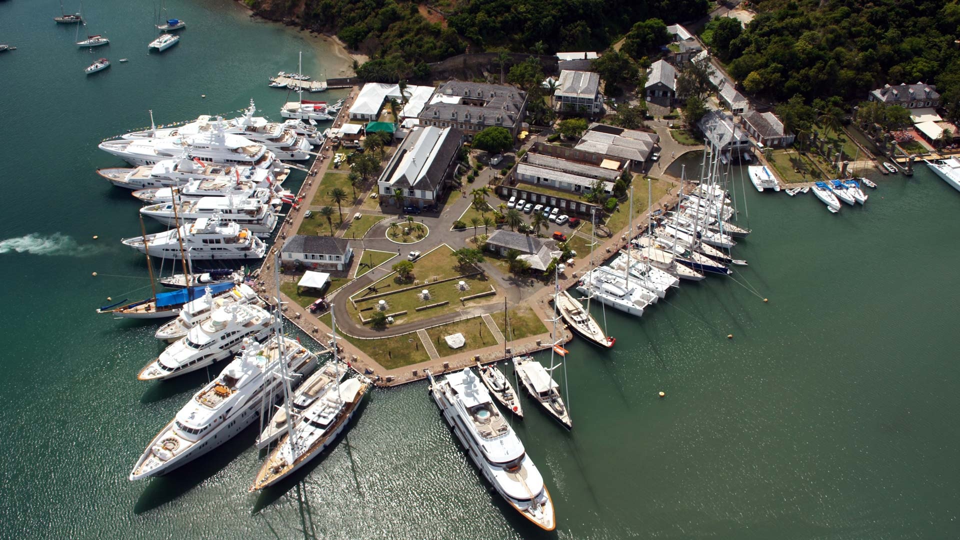
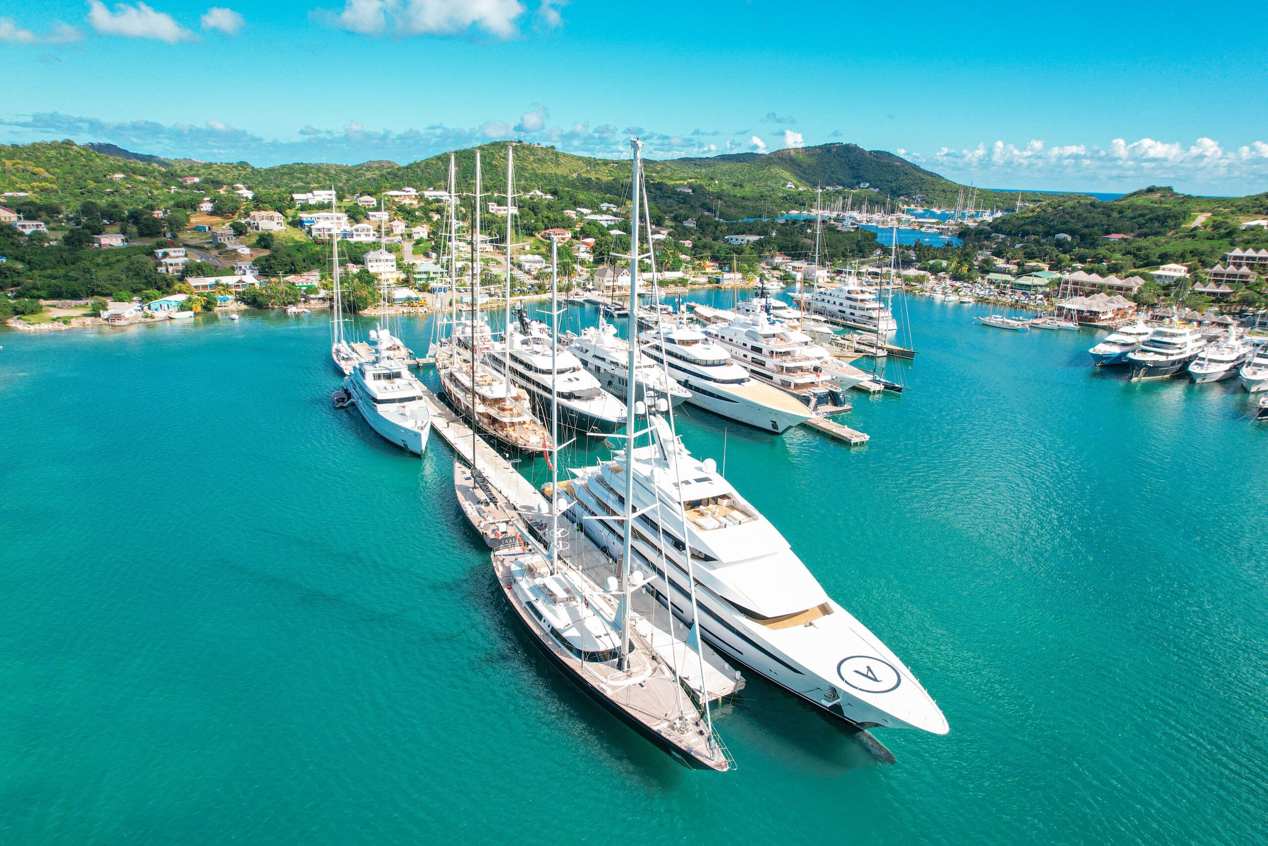
The aerial view is an unusually good introduction here. English Harbour is not a broad, anonymous waterfront. Its enclosure and surrounding landforms help explain why naval infrastructure developed in this particular place. The dockyard sits within a larger landscape, rather than functioning as an isolated historic monument placed beside the sea.
Falmouth Harbour provides a different visual register. In the marina’s official photography, rows of yachts and sailing rigs occupy a wider field of water, with the hills and settlement beyond. The contrast is not a competition between old and new. It is a useful way of reading two neighbouring maritime environments that contribute different things to a stay.
For a yacht-based itinerary, this is the first reason to give the area time ashore. Arriving, stepping off the boat and taking a longer view of the harbour can be part of the destination itself. The value is not in adding another pin to a map. It is in understanding how the landscape, buildings and present-day marine activity fit together.
A working dockyard, a longer history
Nelson’s Dockyard is part of the World Heritage property formally named the Antigua Naval Dockyard and Related Archaeological Sites, inscribed in 2016. The National Parks Authority describes a working Georgian-era dockyard whose significance combines buildings, heritage and environment. That combination matters: the water, shore and defensive landscape belong to the story as much as the individual structures.
The dockyard’s appearance can invite an easy aesthetic reading of restored masonry, boats and tropical vegetation. A fuller account includes the people whose work made the place possible. The National Parks Authority records the forced labour of enslaved Africans in its construction and identifies enslaved shipwrights, blacksmiths, carpenters, caulkers and sailmakers among the skilled workforce.
That history is central to an informed visit. It changes what a workshop, quay or storehouse represents, and prevents the architecture from becoming a picturesque backdrop detached from the colonial economy that produced it. A destination can be beautiful and still ask for careful attention. The strongest travel experiences often make room for both.
The familiar name is itself a later layer. The Authority traces the site’s earlier identity as His Majesty’s Yard in English Harbour or the Antigua Naval Dockyard, with the Nelson association becoming part of its later heritage presentation. Reading those layers makes the present place more interesting: a naval facility, a period of abandonment, restoration, and a continuing maritime life.
A harbour seen from above
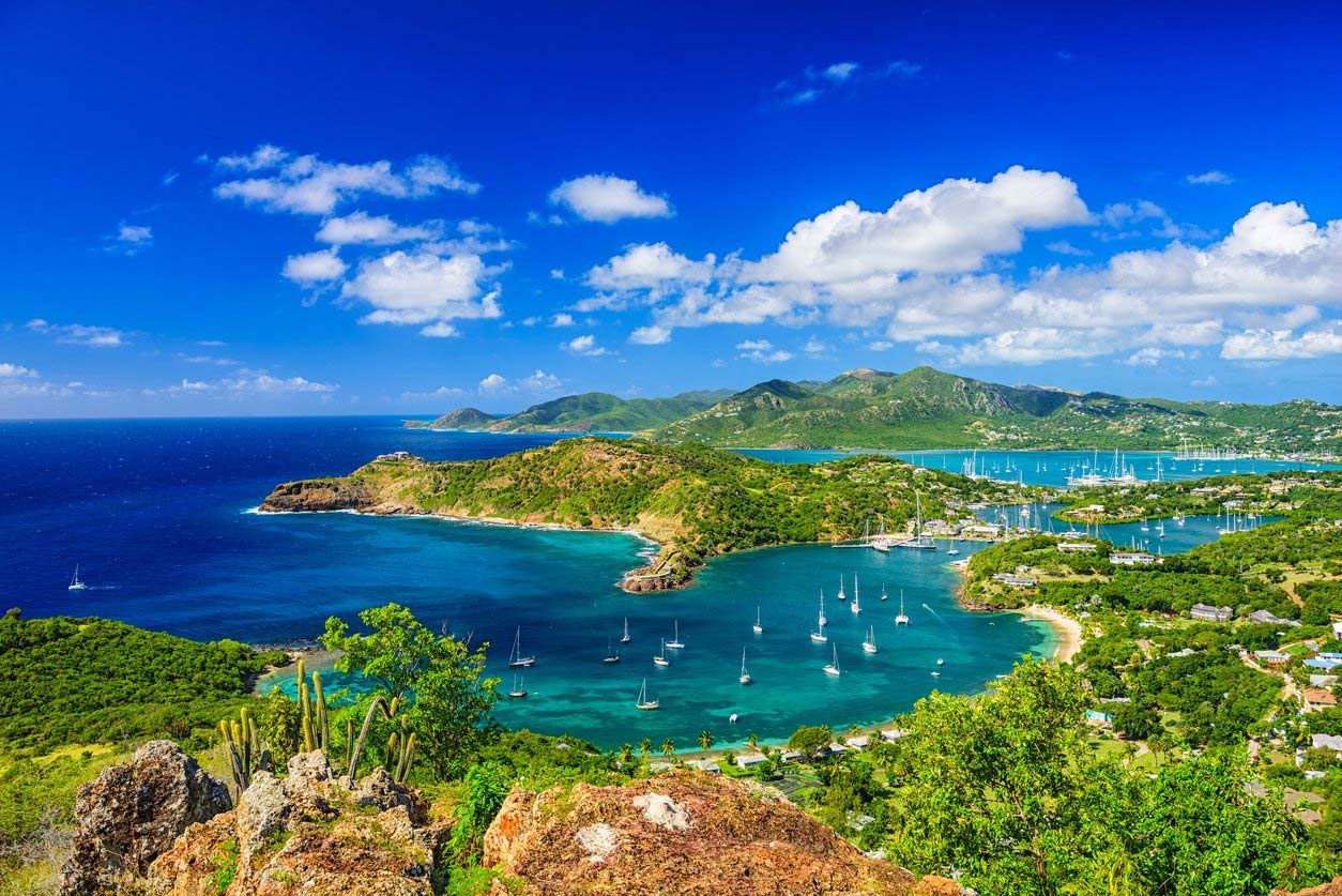
Shirley Heights offers the complementary perspective. The National Parks Authority’s official view places the harbour within its surrounding hills and coastline, making relationships visible that are harder to understand from a quay. Water, settlement and the open sea occupy different parts of the same frame.
For a visitor, the change of height is also a change of attention. At water level, a yacht or building fills the foreground. From above, the landforms take precedence and the harbour becomes part of a larger geography. It is a useful counterpoint to time spent on board, where movement is usually read across the surface rather than down into a landscape.
The point is not to prescribe a hurried circuit of viewpoints. A good shore programme can be modest: enough time for the dockyard’s history, a considered change of perspective and an unforced return to the water. Access arrangements, weather and the interests of the party should determine the detail, rather than an itinerary built around collecting photographs.
Falmouth is also a place of work
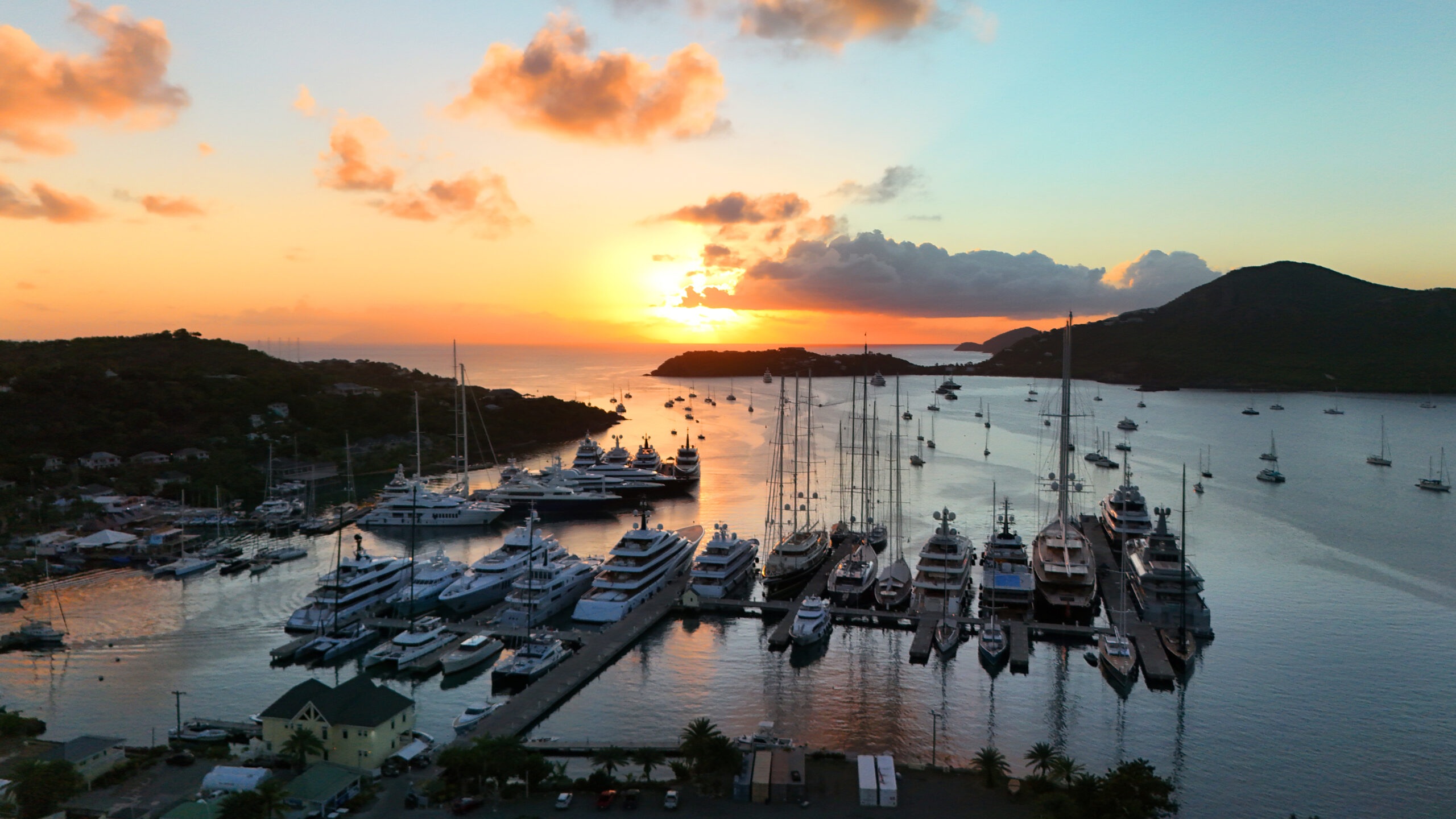
Falmouth Harbour Marina brings the contemporary marine ecosystem into view. Its official presentation includes berthing and shoreside services, while the gallery shows the practical scale of the quays, the concentration of sailing rigs and the relationship between vessels and the surrounding shore. This is infrastructure serving boats and people, not simply a backdrop for yachts at sunset.
For the guest, much of that work remains discreet. Provisioning, technical support, water and fuel arrangements, and the coordination of movements sit behind an apparently effortless day. Looking at the marina as a working place gives a more complete understanding of a destination’s appeal. A beautiful anchorage and a capable shore network answer different needs within the same voyage.
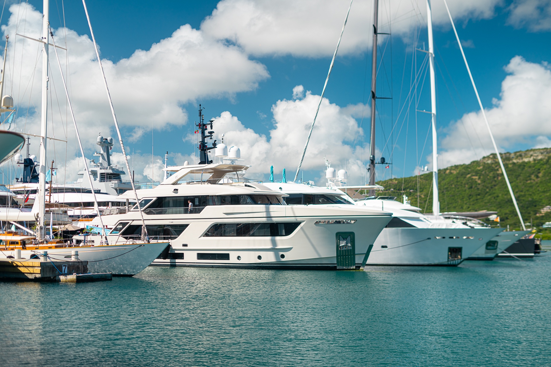
The photographs taken along the pontoons are useful precisely because they restore human scale. The broad aerial becomes a walkway, a gangway, a distance between two hulls. For a prospective charterer, those details help frame sensible questions about embarkation, mobility, luggage and the preferences of the group. The answers must come from the actual yacht and marina arrangements, not from assumptions made from a wide photograph.
Give the charter brief a shore chapter
Antigua’s appeal is easier to use when the charter brief describes more than a succession of bays. Some guests will want time with the dockyard’s interpretation and buildings. Others will be most interested in the contemporary sailing scene or a landscape view. Those interests can coexist if they are discussed before every day is allocated to movement.
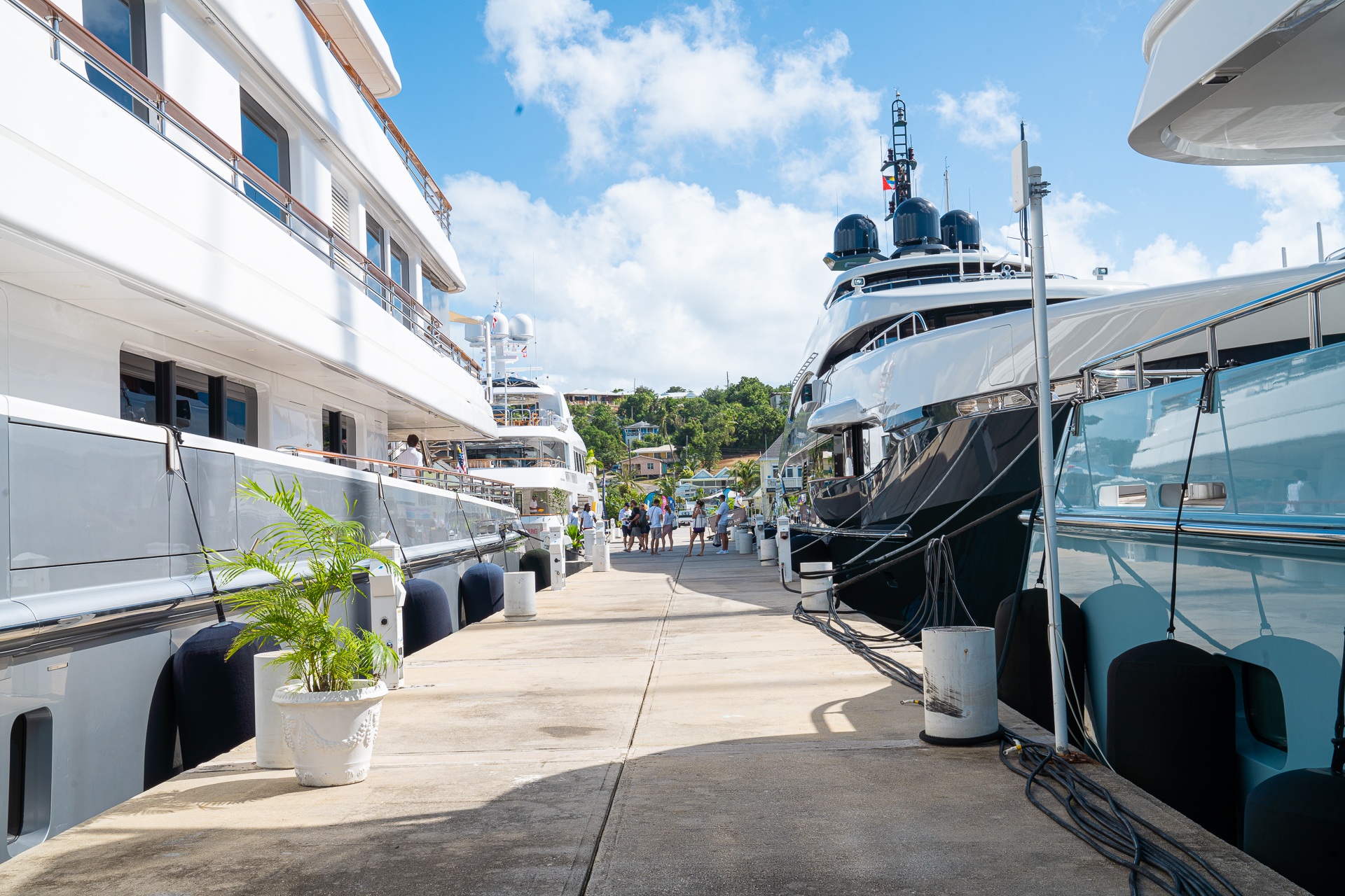
The useful distinction is between a destination wish and an operational commitment. A wish might be an unhurried afternoon ashore in the English Harbour area, followed by a return to the yacht. The commitment depends on the captain’s judgement, weather, the yacht’s dimensions, berth arrangements and the current requirements of the relevant authorities. Keeping those levels separate makes the planning clearer without making the experience feel bureaucratic.
It also improves the commercial conversation. A charter manager can respond more intelligently to the way a party likes to spend time than to a list of interchangeable place names. Our guide to a better yacht charter brief develops that approach through the day aboard; Antigua gives the same idea a strong shoreside counterpart.
Two harbours, different questions
A destination notebook is most useful when it distinguishes settings and purposes. These are prompts for planning with the yacht’s team, not navigational directions or confirmed reservations.
| Setting | Why give it time | A useful planning question |
|---|---|---|
| Nelson’s Dockyard | A working maritime setting with interpreted architectural and social history. | How much unhurried shore time does the party want for the site and its interpretation? |
| Shirley Heights | A wider reading of the harbour landscape from above. | Which access arrangements suit the group’s interests and mobility? |
| Falmouth Harbour Marina | A contemporary yachting setting and shoreside service network. | What embarkation, berth and support arrangements are actually confirmed for this yacht? |
| The day between sea and shore | A balance of on-board privacy and time within a destination. | Which parts of the programme should remain flexible for weather and the captain’s decisions? |
The return to the water
Returning to the marina offers a different perspective from the elevated harbour view. The boats, pontoons and surrounding hills become parts of a more immediate landscape, measured through the movement between shore and water. It is a useful way to end a day that has explored the harbour at several different scales.
That is the distinctive possibility of this corner of Antigua. It can support an itinerary that moves between private life aboard, a working yacht community and a historically significant shore. Each has its own character. Allowing those characters to remain distinct produces a richer experience than treating every waterfront as another version of the same luxury port.
Sources & credits
Sources and methodology
This is a source-led destination portrait, not a report of a hosted visit, a navigational guide or a confirmation of charter availability. The National Parks Authority’s dockyard account establishes the site’s history and the contribution of enslaved workers. Its World Heritage account and Shirley Heights information provide the heritage and landscape context. Contemporary marina information and photographs were checked against Falmouth Harbour Marina, its gallery and services. No photographed yacht is represented as available for charter. Berthing, access and official formalities require current confirmation with the responsible teams. Sources reviewed on 4 November 2026.